Transform Your Real Estate Listings with Drone Photography for Real Estate
- Guy Nehrenz
- Dec 16, 2025
- 4 min read
In today’s competitive market, standing out is essential. Traditional photos and videos often fail to capture the full potential of a property. This is where drone photography for real estate comes in. Using aerial shots, you can showcase properties from unique perspectives, highlight surrounding amenities, and provide a comprehensive view that grabs attention. This technology is revolutionizing how listings are presented, making them more engaging and informative.
Why Drone Photography for Real Estate is a Game-Changer
Drone photography offers a fresh way to present properties. Instead of just showing rooms and interiors, drones capture the entire environment. This includes the property’s size, layout, landscaping, and nearby features like parks, schools, or bodies of water. These visuals help potential buyers or investors get a better feel for the location and value.
Some key benefits include:
Enhanced Visual Appeal: Aerial shots create stunning images that stand out in listings.
Better Property Context: Show how the property fits into the neighborhood or landscape.
Highlight Unique Features: Pools, gardens, driveways, and roof conditions are easier to showcase.
Increased Engagement: Listings with drone photos tend to attract more views and inquiries.
Cost-Effective Marketing: Compared to traditional methods like helicopter shots, drones are affordable and flexible.
For example, a high-angle view of a sprawling estate can reveal its full scale and layout, something ground-level photos cannot achieve.

How to Get Started in Real Estate Drone Photography?
Starting with drone photography for real estate requires some preparation and knowledge. Here’s a step-by-step guide to help you begin:
Research Local Regulations
Before flying, check your country or region’s drone laws. Many places require registration, permits, or pilot certification.
Choose the Right Drone
Invest in a drone with a high-quality camera, stable flight controls, and GPS features. Popular models include DJI Mavic Air 2 and Phantom 4 Pro.
Learn to Fly Safely
Practice flying in open areas to master controls and avoid accidents. Safety is crucial, especially near buildings and people.
Understand Real Estate Needs
Talk to real estate agents or marketing professionals to learn what shots are most effective. Focus on angles that highlight property strengths.
Plan Your Shots
Create a shot list including wide aerial views, close-ups of key features, and smooth video flyovers.
Edit and Enhance
Use photo and video editing software to improve lighting, color, and clarity. This makes your content more professional.
Market Your Services
Build a portfolio and share your work on websites, social media, and real estate platforms.
By following these steps, you can quickly become proficient and offer valuable drone photography services tailored to real estate marketing.
Practical Tips for Capturing Stunning Real Estate Drone Photos
To maximize the impact of your drone shots, consider these practical tips:
Shoot During Golden Hours
Early morning or late afternoon light creates warm tones and soft shadows, enhancing the property’s appearance.
Use Different Angles
Combine wide shots with mid-range and close-up aerial views to provide a complete picture.
Show Surroundings
Include nearby amenities like parks, schools, or waterfronts to add value.
Keep It Steady
Use drone gimbals and smooth flight paths to avoid shaky footage.
Mind the Weather
Clear skies and calm winds produce the best results.
Respect Privacy
Avoid capturing neighboring properties without permission.
Incorporate Video
Short drone videos with smooth transitions can be more engaging than still photos alone.
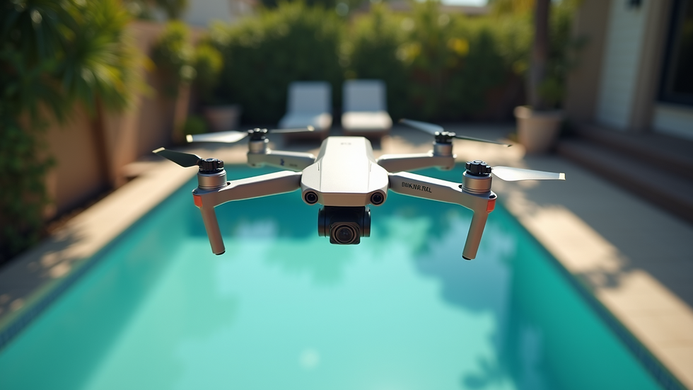
For instance, a low-angle flyover of a backyard pool area can highlight its size and design, enticing potential buyers.
How Drone Photography Enhances Marketing and Mapping in Construction and Real Estate
Beyond just beautiful images, drone photography plays a vital role in marketing and mapping for construction and real estate projects. Here’s how:
Progress Monitoring
Construction companies use drones to track project progress from above, identifying delays or issues early.
Site Mapping
Drones create accurate maps and 3D models of construction sites, aiding planning and design.
Marketing Materials
Real estate agents use aerial photos and videos in brochures, websites, and social media to attract buyers.
Virtual Tours
Combining drone footage with virtual reality offers immersive property tours.
Competitive Advantage
Offering drone photography services sets businesses apart in a crowded market.
By integrating drone technology, companies can improve efficiency, transparency, and customer engagement.
Future Trends in Drone Photography for Real Estate
The future of drone photography in real estate looks promising with ongoing technological advancements. Some trends to watch include:
AI and Automation
Drones equipped with AI can automatically capture optimal shots and avoid obstacles.
Higher Resolution Cameras
Improved sensors will deliver even sharper images and videos.
Live Streaming
Real-time drone footage can be broadcast during open houses or virtual tours.
Integration with Smart Home Tech
Combining drone views with smart home data for a comprehensive property experience.
Eco-Friendly Drones
More energy-efficient models will reduce environmental impact.
Staying updated with these trends will help businesses maintain a competitive edge and offer cutting-edge services.
By embracing drone photography for real estate, you can transform how properties are showcased and marketed. This innovative approach not only enhances visual appeal but also provides valuable insights for buyers, sellers, and developers alike. Whether you are involved in construction, real estate, marketing, or mapping, leveraging drone aerial photography will elevate your projects and listings to new heights.
For more information on how to incorporate this technology into your business, explore real estate drone photography services and resources.


Comments